

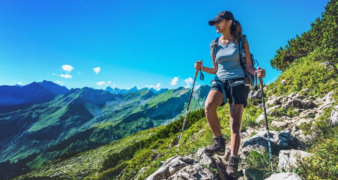
Ask any hiker to name the finest Routeburn Track route in New Zealand and the Routeburn Track comes up within seconds. This 33-kilometre alpine trail links two national parks on the South Island and packs an unreasonable amount of scenery into two to four days: beech forests dripping with moss, waterfalls that soak the trail after rain, glacier-carved valleys, and a high mountain pass with views across the Darran Mountains.
The track sits inside Te Wahipounamu, a UNESCO World Heritage Area, and holds official Great Walk status, which means well-built paths, serviced huts, and a booking system that keeps crowds manageable. That combination makes it one of the most accessible ways to experience trekking in New Zealand at a genuinely alpine level.
This guide covers everything you need to plan the trip: route details, month-by-month Routeburn Track weather, difficulty and fitness requirements, a full 3-day itinerary, packing lists, hut bookings, transport, costs, and nearby adventures such as mountain Routeburn Track and horse trekking around Queenstown. Whether this is your first multi-day trek or your twentieth, you will find the practical details here.
What Makes Routeburn Track One of the Best Trekking Experiences?
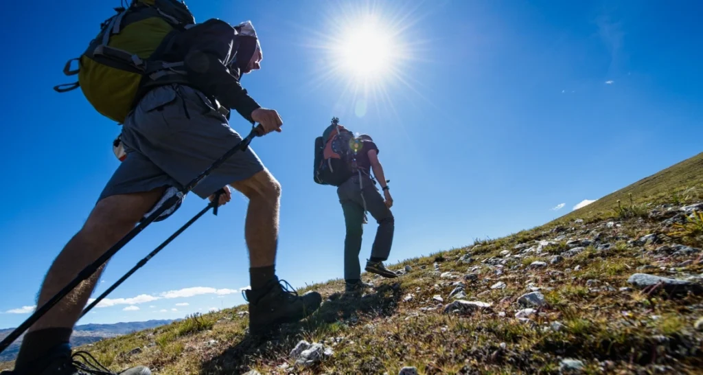
New Zealand has ten Great Walks, and hikers argue endlessly about which one deserves the top spot. The Routeburn Track wins many of those arguments for a simple reason: no other short trek in the country spends so much time above the treeline. On the Milford Track you walk through valleys and look up at the mountains. On the Routeburn, you walk among them.
A Journey Through Fiordland and Mount Aspiring National Parks
The track connects two of New Zealand’s largest national parks. It begins (or ends, depending on your direction) at Routeburn Track Shelter in Mount Aspiring National Park near Glenorchy, and finishes at The Divide on the Milford Road inside Fiordland National Park. Both parks form part of Te Wahipounamu, the South West New Zealand World Heritage Area, recognised for landscapes shaped by glaciers over millions of years.
The variety over 33 kilometres is what surprises most trekkers. You start in red beech forest along the turquoise Route Burn river, climb through subalpine scrub past a hanging valley, cross exposed tussock slopes beneath the Serpentine Range, and traverse a rocky saddle at 1,255 metres before descending past an alpine lake back into rainforest thick enough to feel prehistoric. Few trekking routes anywhere compress that much ecological change into three days of walking.
Highlights You Will Experience During the Trek
Several individual features have become famous in their own right, and each one earns its reputation:
- Harris Saddle (1,255 m): the highest point on the main track, with views over the Hollyford Valley to the Darran Mountains and, on clear days, out to the Tasman Sea.
- Lake Harris: a deep glacial lake sitting just below the saddle, often still holding ice into early summer.
- Lake Mackenzie: an alpine lake ringed by ribbonwood forest and the Emily Peak cirque, home to one of the track’s two main huts.
- Earland Falls: a 174-metre waterfall that lands close enough to the trail to spray trekkers on windy days.
- Key Summit: a side trip near The Divide with a nature walk across alpine wetlands and a three-valley panorama.
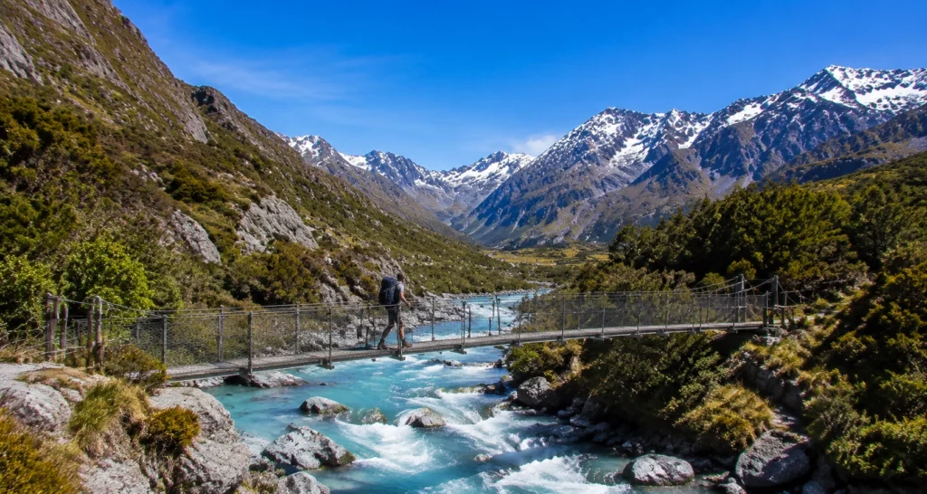
- Swing bridges: several suspension bridges cross the Route Burn and its tributaries, a classic New Zealand Routeburn Routeburn Track experience.
| Highlight | Why It Is Special |
|---|---|
| Harris Saddle | Highest point on the track with views across the Darran Mountains |
| Lake Mackenzie | Alpine lake scenery beside a serviced Great Walk hut |
| Lake Harris | Glacial lake below the saddle, dramatic in every season |
| Earland Falls | 174 m waterfall that drops beside the trail |
| Key Summit | Panoramic viewpoint over the Hollyford, Greenstone and Eglinton valleys |
| Swing bridges | Suspension crossings over the turquoise Route Burn |
The other thing that sets the Routeburn apart is infrastructure. The Department of Conservation (DOC) maintains the track to a high standard, so trekkers spend their energy on the climbs rather than on route-finding. For anyone stepping up from day hikes to multi-day Routeburn Track, that safety margin matters.
Routeburn Track Overview: Distance, Duration & Route Details
Before booking anything, get the basic shape of the trip clear in your head. The Routeburn Track is a one-way (point-to-point) trail, not a loop, and the two trailheads sit about 350 kilometres apart by road even though they are only 33 kilometres apart on foot. That single fact drives most of your transport planning.
Routeburn Track Distance and Elevation
The main track measures 33 kilometres (about 20.5 miles). Most people complete it in 2 to 4 days, with 3 days being the classic itinerary. Fit trekkers sometimes walk it in two long days, while trail runners race the whole thing in a morning. There is no reason to rush, though; the side trips to Key Summit and Conical Hill are among the best parts.
Elevation is the real measure of effort. Routeburn Shelter sits at roughly 480 metres, and The Divide at about 530 metres, but the track climbs to 1,255 metres at Harris Saddle in between. Expect a total ascent of around 1,100 to 1,300 metres across the trek depending on side trips. The track can be walked in either direction. Starting from The Divide spreads the climbing more gently; starting from Routeburn Shelter gets the steepest ascent done on fresh legs.
Starting Points of Routeburn Track
Routeburn Shelter is the eastern trailhead, 68 kilometres from Queenstown via Glenorchy at the head of Lake Wakatipu. The Divide is the western trailhead on the Milford Road (State Highway 94), about 85 kilometres from Te Anau, and is the lowest road crossing of the Southern Alps. Most trekkers base themselves in Queenstown or Te Anau, use a shuttle to reach one end, and arrange transport back from the other.
| Category | Details |
|---|---|
| Distance | 33 km (20.5 miles) one way |
| Duration | 2 to 4 days (3 days is standard) |
| Difficulty | Intermediate Great Walk |
| Highest point | Harris Saddle, 1,255 m |
| Location | South Island, New Zealand (Mount Aspiring & Fiordland National Parks) |
| Best season | Late October to April (Great Walk season) |
| Trailheads | Routeburn Shelter (near Glenorchy) and The Divide (Milford Road) |
Best Time for Trekking the Routeburn Trekking
Timing shapes everything on this trail: safety, cost, crowds, and what the mountains actually look like. New Zealand’s seasons run opposite to the northern hemisphere, so summer Routeburn Track happens between December and February.
Great Walk Season (Late October to April)
DOC operates the official Great Walk season from late October through the end of April. During these months the huts are fully serviced with gas cooking stoves, running water, flush toilets, and resident wardens who give nightly weather briefings. Bridges are all in place, the track is actively maintained, and daylight stretches long enough for relaxed walking days.
This is when the overwhelming majority of trekkers walk the Routeburn, and for good reason. Conditions are as forgiving as this alpine environment gets, and the warden briefings alone are worth the hut fee for anyone new to Routeburn Track in New Zealand. The trade-off is demand: bookings for peak dates around Christmas and January can sell out within days of opening.
Off-Season Trekking (May to September)
Outside the Great Walk season, the Routeburn changes character completely. Snow buries the alpine section, several avalanche paths cross the track between Lake Mackenzie and Routeburn Falls, and DOC removes some bridges to protect them from avalanche damage. Huts drop to basic status: no gas, no wardens, and limited heating.
Winter Routeburn Track here is a serious mountaineering objective, not a harder version of the summer walk. It requires ice axe and crampon skills, avalanche training and transceivers, and honest self-assessment. If you visit between May and September and want a taste of the track, a day walk from The Divide to Key Summit (checking avalanche advisories first) or from Routeburn Shelter to the Flats is a far safer choice than attempting a full crossing.
Routeburn Track Weather Guide: What You Need to Know
If one factor decides how much you enjoy this trek, it is Routeburn Track weather. The trail sits on the boundary between Fiordland, one of the wettest places on Earth, and the drier ranges toward Wakatipu. Weather systems roll off the Tasman Sea with little warning, and conditions on Harris Saddle can shift from t-shirt sunshine to horizontal sleet within an hour, in any month of the year.
Monthly Routeburn Track Weather Conditions
The figures below are a general planning guide for the alpine sections. Valley floors run warmer; the saddle runs colder and windier. Annual rainfall near the Fiordland end can exceed 5 metres, so plan on getting rained on at some point regardless of the month you choose.
| Month | Typical Temperature | Conditions | Recommended? |
|---|---|---|---|
| October | 3–13°C | Spring melt, lingering snow patches, changeable | Good for experienced trekkers |
| November | 5–15°C | Warming, waterfalls at full flow | Good |
| December | 7–18°C | Early summer, long daylight, busy | Excellent |
| January | 9–20°C | Warmest month, busiest trails | Excellent |
| February | 9–19°C | Settled summer weather | Excellent |
| March | 7–17°C | Stable, fewer crowds, autumn light | Best overall |
| April | 4–13°C | Cooling fast, quieter, early snow possible | Good, come prepared |
| May–September | -5–8°C | Snow, ice, avalanche risk, facilities reduced | Alpine experts only |
Many experienced trekkers rate March as the sweet spot: school holidays are over, the weather is at its most settled, and the huts feel sociable rather than packed.
How Weather Impacts Trekking Plans
Rain is the most common disruption. Heavy downpours swell side streams, and unbridged crossings can become impassable for hours. The rule every warden repeats: if you cannot see the bottom, do not cross. Wait for the water to drop, which in this catchment usually happens quickly once the rain stops.
Wind matters most on the exposed stretch between Routeburn Falls and Lake Mackenzie via Harris Saddle. Gusts strong enough to knock adults off their feet occur several times each season, and wardens will sometimes advise groups to hold at a hut until a front passes. Build a spare day into your travel plans so a weather delay costs you nothing but time.
Snow can dust the saddle even in January. It rarely settles for long in summer, but it turns rock slabs slippery and hides trail markers. Check the DOC website and the MetService Fiordland forecast in the days before you start, attend the hut briefings, and treat forecasts on this track as suggestions rather than promises.
Routeburn Track Difficulty Level: Is It Suitable for Beginners?
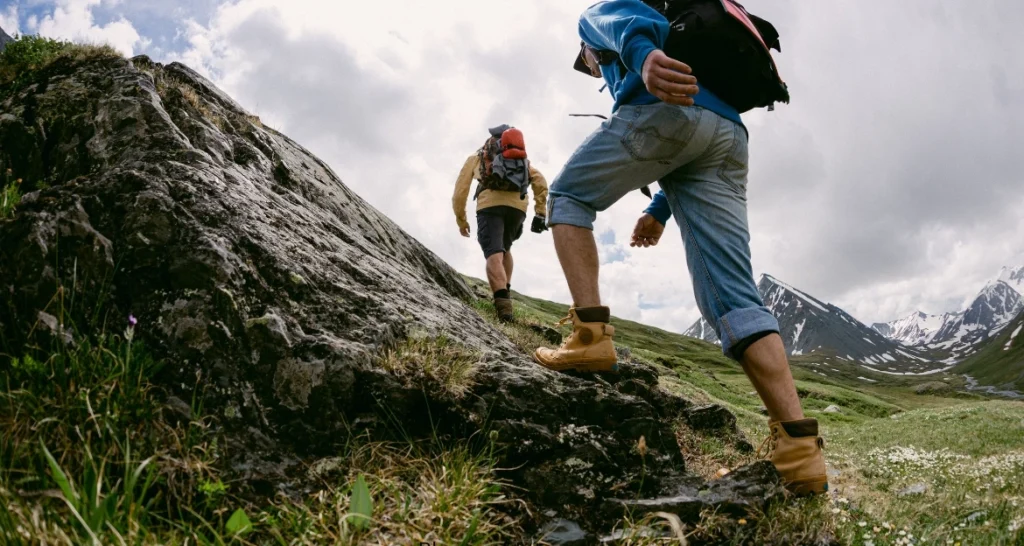
Is the Routeburn Track suitable for beginners? Yes, for fit beginners in the Great Walk season. The track is well formed and clearly marked, daily distances stay under 12 kilometres, and huts remove the need to carry a tent. If you can comfortably walk 5 to 6 hours on hilly terrain with a loaded pack, you can complete this trek. Total novices should train for at least six weeks first.
Fitness Requirements for Trekking
On a standard 3-day itinerary, you will walk 4 to 6 hours per day carrying a pack of 8 to 12 kilograms. Day two involves roughly 500 to 700 metres of climbing to Harris Saddle followed by a long descent, which many trekkers find harder on the knees than the ascent was on the lungs. DOC grades the Routeburn as an intermediate Great Walk, a notch above the flat Milford Track valley stages but well below true mountaineering routes.
The honest test: find a local hill and climb 500 vertical metres with a weighted pack. If you can do that and still hold a conversation, you are ready. If you finish gasping, give yourself more training time rather than more anxiety on the trail.
Training Tips Before Your Trek
- Hill walking: build up to back-to-back weekend hikes of 4 to 5 hours on undulating terrain, wearing the boots and pack you will take on the trek.
- Cardio training: two or three sessions a week of hiking, running, cycling, or stair climbing for 30 to 45 minutes will cover the aerobic demand.
- Strength work: squats, lunges, step-ups, and calf raises protect your knees on the long descents. Twice a week for six weeks makes a noticeable difference.
- Pack conditioning: do at least two training walks with your full Routeburn Track load. Shoulders and hips need practice as much as legs do.
Complete Routeburn Track 3-Day Trekking Itinerary
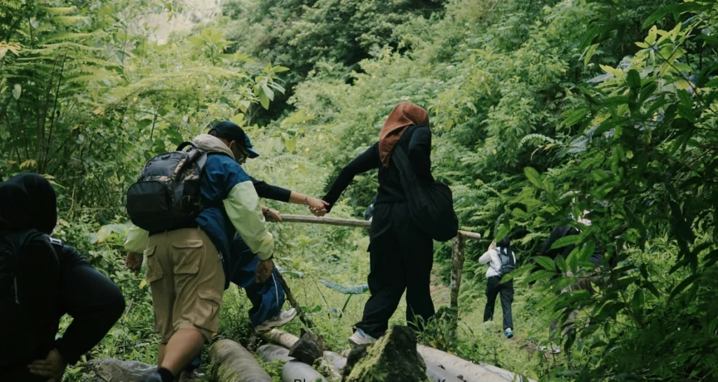
The itinerary below runs west to east, from The Divide to Routeburn Shelter. Walking this direction gives a gentler first day, saves the biggest views for day two, and ends with an easy forest descent close to Queenstown transport. Reverse it if hut availability or shuttle timings work better the other way; the track is equally good in both directions.
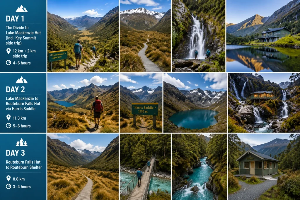
Day 1: The Divide to Lake Mackenzie Hut (12 km, 4–6 hours)
The day starts with a steady climb through silver beech forest from The Divide car park (532 m). After about an hour, drop your pack at the junction and take the Key Summit side trip: 45 minutes up to an alpine boardwalk loop with views into three glacial valleys. On a clear morning this detour alone justifies the whole trek.
Back on the main track, descend past the site of the former Lake Howden Hut and sidle along forested slopes high above the Hollyford Valley. Earland Falls arrives at about the halfway mark, thundering 174 metres down beside the trail; after heavy rain you will walk through its spray. The track then passes a clearing known as The Orchard before a final gentle climb delivers you to Lake Mackenzie Hut, set beside one of the prettiest alpine lakes in the country. Swim if you dare. The water rarely rises above bracing.
Day 2: Lake Mackenzie to Routeburn Falls Hut (11.3 km, 5–6 hours)
This is the queen stage and the reason the Routeburn ranks among the world’s great short treks. The day begins with a sharp zigzag climb out of the Mackenzie basin, breaking above the treeline within the first hour. From there the track traverses open tussock slopes on the flank of the Hollyford face for several kilometres, with the Darran Mountains filling the horizon and, on clear days, a glint of the Tasman Sea at Martins Bay.
Harris Saddle (1,255 m) marks the high point and the boundary between the two national parks. The emergency shelter here makes a good lunch stop. If the weather is stable and your legs agree, the Conical Hill side trip climbs another 250 vertical metres for a 360-degree panorama; allow 1 to 1.5 hours return. From the saddle, the track skirts the shore of Lake Harris, a dark glacial bowl that holds ice well into summer, then descends into the head of the Routeburn valley to reach Routeburn Falls Hut, perched dramatically beside a chain of cascades at 1,000 metres. This stage is the most weather-exposed section of the entire trek, so start early and take the warden’s morning briefing seriously.
Day 3: Routeburn Falls Hut to Routeburn Shelter (8.8 km, 3–4 hours)
The final day is a gentle downhill cruise. The track drops steeply for the first half hour beside the falls, then flattens across Routeburn Flats, a golden tussock valley floor ringed by peaks where you have a genuine chance of hearing kea, the world’s only alpine parrot. From the Flats, the trail re-enters red beech forest and follows the Route Burn itself, an absurdly turquoise river that the track crosses on swing bridges.
Highlights come thick in the last hour: the bridged gorge where the river squeezes between polished rock, side creeks tumbling out of Emily Creek, and moss-covered forest that feels borrowed from a fantasy film. You will reach Routeburn Shelter by early afternoon with time for the drive back to Queenstown, ideally with a stop at a Glenorchy cafe to begin the important work of replacing calories.
| Day | Route | Distance | Walking Time |
|---|---|---|---|
| Day 1 | The Divide → Lake Mackenzie Hut (incl. Key Summit side trip) | 12 km + 2 km side trip | 4–6 hours |
| Day 2 | Lake Mackenzie → Routeburn Falls Hut via Harris Saddle | 11.3 km | 5–6 hours |
| Day 3 | Routeburn Falls Hut → Routeburn Shelter | 8.8 km | 3–4 hours |
Trekkers with four days often add a night at Routeburn Flats Hut to slow the finish, while strong walkers compress the trip into two days by pushing from The Divide straight through to Routeburn Falls. The 3-day version remains the best balance of effort and enjoyment for most people.
Essential Packing Checklist for Routeburn Trekking
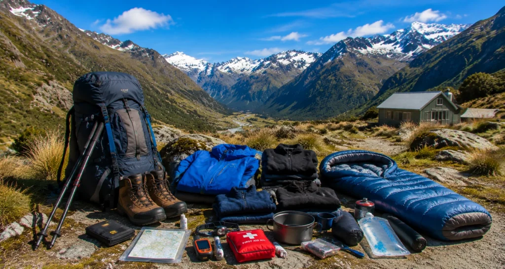
Packing for the Routeburn means preparing for four seasons in three days. The huts provide mattresses, gas stoves (in season), and shelter, which keeps your load lighter than a full camping trip, but everything else travels on your back. Aim for a total pack weight of 8 to 12 kilograms including food and water.
Clothing and Footwear
Cotton has no place on this trail; once wet, it stays wet and steals body heat. Build your system from wool or synthetics:
- Worn-in hiking boots with ankle support and solid tread. The descents will punish new or worn-out footwear.
- A genuinely waterproof jacket with a hood, not a shower-resistant one. This is the single most important item you will carry.
- Waterproof overtrousers for the saddle crossing in wind and rain.
- Two thermal base layers (merino or polypropylene) plus a fleece or light insulated jacket.
- Quick-dry shorts or Routeburn Track trousers, three pairs of wool socks, warm hat, sun hat, and gloves, even in January.
- Lightweight hut shoes or sandals so your feet can recover each evening.
Safety Equipment
- First aid kit including blister treatment, painkillers, and any personal medication.
- Headlamp with spare batteries; hut lighting is minimal and switches off early.
- Navigation: the track is well marked, but carry the NZ Topo50 map or an offline mapping app as backup. There is no mobile coverage on most of the route.
- Power bank for phone and camera; huts have no charging points.
- Personal locator beacon (PLB). Rentable in Queenstown and Te Anau for a few dollars a day, and the difference between a bad afternoon and a tragedy if things go wrong.
- Sunscreen and sunglasses. Alpine UV in New Zealand burns fast, even through cloud.
- Emergency survival bag or blanket, whistle, and a small repair kit.
Food and Water Requirements
Carry all food for the full trek plus one spare day in case weather holds you at a hut. Freeze-dried meals, instant noodles, wraps, cheese, salami, nuts, chocolate, and porridge are the standard Routeburn Trekking menu. Plan on roughly 700 to 900 grams of food per person per day. In-season huts supply gas cookers, but you must bring your own pot, mug, utensils, and a sleeping bag rated to at least 0°C.
Water is plentiful. Hut tap water is generally fine to drink, and most trekkers refill from side streams along the way. Carry purification tablets or a filter if you prefer certainty, and hold 1 to 1.5 litres of capacity for the exposed saddle section where sources are fewer.
| Item | Required? |
|---|---|
| Waterproof jacket & overtrousers | Yes, non-negotiable |
| Worn-in hiking boots | Yes |
| Sleeping bag (0°C rating) | Yes |
| Thermal layers & fleece | Yes |
| Headlamp + spare batteries | Yes |
| First aid kit & blister care | Yes |
| Food for all days + 1 spare day | Yes |
| Water bottle/bladder (1.5 L) + purification | Yes |
| Personal locator beacon | Strongly recommended |
| Power bank | Recommended |
| Routeburn Track poles | Recommended for the descents |
| Hut shoes/sandals | Optional but appreciated |
Routeburn Track Hut Booking and Accommodation Guide
Accommodation on the Routeburn runs through the Department of Conservation’s Great Walks booking system, and during the season it is compulsory: no booking, no bed, and rangers do check.
DOC Hut System Explained
Three serviced huts sit on the track: Routeburn Falls Hut (48 bunks), Lake Mackenzie Hut (50 bunks), and Routeburn Flats Hut (20 bunks). In season, each provides bunk mattresses, gas cooking stoves, running water, flush toilets, heating, and a resident warden. You bring your own sleeping bag, food, and cooking gear.
Bookings open on the DOC website (doc.govt.nz) around May or June for the following season, and popular dates, especially late December through January, can sell out within days or even hours. Great Walk hut fees are charged per person per night and differ for New Zealand residents and international visitors; as a rough guide, budget NZ$50–80 per night for residents and NZ$100–150 for international adults, and check the DOC website for current rates before you plan. Set a calendar reminder for booking day, have two or three date options ready, and be flexible on direction. Bookings for the Great Walks season are essential, and midweek dates in November or March offer the best availability.
Camping vs Hut Stay
Two designated campsites operate in season, at Routeburn Flats and Lake Mackenzie, for a lower nightly fee (roughly NZ$20–45 per adult depending on residency). Camping is not permitted anywhere else on the track, and there is no campsite near Harris Saddle, which forces campers into a specific itinerary shape. Freedom camping is banned throughout.
| Option | Benefits | Challenges |
|---|---|---|
| Hut stay | Warm, dry, gas cooking, warden briefings, lighter pack | Higher cost, books out fast, shared bunkrooms |
| Camping | Cheaper, quieter sites, more solitude | Carry tent and stove, colder nights, limited site choice, sandflies |
Transport Options for Routeburn Track
Because the trailheads sit on opposite sides of the mountains, transport deserves as much planning as the Routeburn Track itself. The road journey between Routeburn Shelter and The Divide takes around 4.5 to 5 hours via Queenstown and Te Anau.
Getting to Routeburn Shelter
The eastern trailhead is a 75-minute drive from Queenstown along one of New Zealand’s most scenic roads, hugging Lake Wakatipu to Glenorchy and continuing 25 kilometres (partly unsealed) to the shelter. Scheduled shuttle services run daily in season from Queenstown and Glenorchy, typically costing NZ$45–65 per person one way.
Getting to The Divide
The western trailhead sits on the Milford Road, about one hour from Te Anau and roughly 3.5 hours from Queenstown. Trekker shuttles and Milford Sound coaches both stop at The Divide; expect NZ$50–90 per person depending on your starting point. Many trekkers finish here and hop straight onto a Milford Sound cruise connection, which is an excellent way to cap the trip.
Car Relocation and Shuttle Services
If you drive yourself, you have three options: book a car relocation service that moves your vehicle between trailheads while you walk (roughly NZ$250–350 per car), use shuttles in both directions and leave the car in town, or travel as two groups walking opposite directions and swap keys at Harris Saddle. Key-swap is the cheapest but demands trust and coordination. Book any transport at the same time as your huts, because season shuttles fill up alongside the bunks.
Independent Trekking vs Guided Trekking Experience
The Routeburn supports two very different styles of trip, and choosing between them early simplifies every other decision.
Independent Trekking
Walking independently means booking your own DOC huts, carrying your own food and sleeping bag, and managing your own transport. A 3-day independent trek typically costs NZ$300–600 per person all-in for international visitors (huts, shuttles, food, and gear rental), and considerably less for NZ residents. You set your own pace, linger where you like, and share hut evenings with trekkers from around the world.
The costs are non-financial too: you carry 8 to 12 kilograms, you plan every detail, and you are responsible for your own weather calls. For anyone with basic hiking experience, none of that is difficult on a track this well maintained, and the self-reliance is half the satisfaction.
Guided Trekking
One concession-holding operator, Ultimate Hikes, runs guided trips on the Routeburn using its own private lodges at Lake Mackenzie and Routeburn Falls. Guests walk with professional guides, sleep in real beds (with hot showers), eat cooked meals with wine at dinner, and carry only a light day-pack. Prices start around NZ$1,700–2,500 per person for the 3-day trip depending on room type and season.
Guided Routeburn Track suits travellers who want the scenery without the logistics, families introducing kids to multi-day walking, and anyone nervous about alpine weather decisions. The trade-off is cost and a fixed schedule.
| Factor | Independent Trekking | Guided Trekking |
|---|---|---|
| Typical cost (3 days) | NZ$300–600 pp | NZ$1,700–2,500 pp |
| Planning effort | You handle everything | Operator handles everything |
| Pack weight | 8–12 kg | 5–7 kg day-pack |
| Accommodation | DOC bunkrooms | Private lodges, beds, hot showers |
| Meals | Self-catered | Cooked meals included |
| Support & safety | Warden briefings, self-reliant | Professional guides throughout |
| Flexibility | High | Fixed group schedule |
Other Adventure Activities Near Routeburn Track
Most people build the Routeburn into a longer South Island trip, and the surrounding region rewards extra days generously.
Mountain Trekking in New Zealand
If the Routeburn leaves you hungry for more altitude, the South Island offers a lifetime of mountain trekking. The Kepler Track (60 km) from Te Anau spends a full day on an exposed alpine ridgeline. The Greenstone and Caples tracks connect directly to the Routeburn for a 4-to-6-day circuit with far fewer people. Further north, Aoraki/Mount Cook National Park serves up day treks like the Mueller Hut route, a steep climb to a red hut surrounded by glaciers. Gillespie Pass, the Rees-Dart, and Cascade Saddle push into more demanding territory for experienced parties. Every one of these routes shares the Routeburn’s core appeal: big alpine country made accessible by a well-organised hut network.
Horse Trekking Around Queenstown
Not every adventure in this region happens on foot. Horse trekking is a Queenstown and Glenorchy specialty, and the Dart River valley near the Routeburn’s eastern trailhead hosts some of the most scenic rides in the country, including trips through beech forest and river flats used as filming locations for The Lord of the Rings. Operators in Glenorchy, Queenstown, and Cardrona run rides from one hour to full days, with quiet horses and guides who cater to complete beginners. For families with mixed abilities, or for tired legs the day after finishing the track, horse trekking makes a perfect low-effort way to keep enjoying the same landscapes.
More Outdoor Adventures
- Kayaking: paddle Milford Sound beneath 1,000-metre cliffs, or take a sea kayak onto glassy Lake Wakatipu at dawn.
- Cycling: the Around the Mountains and Queenstown Trail networks offer multi-day rides graded for ordinary fitness.
- Wildlife tours: spot kea in the alpine zone, take a birdwatching trip to see rare takahe near Te Anau, or cruise Doubtful Sound for dolphins and fur seals.
- Jet boating: the Dart River jet from Glenorchy combines speed with a guided forest walk in the valley next to the track.
Quick Answers for Trekkers
What is the Routeburn Trekking famous for? The Routeburn Track is famous for its alpine scenery: it crosses Harris Saddle at 1,255 metres between Mount Aspiring and Fiordland National Parks, passing Lake Mackenzie, Lake Harris, and the 174-metre Earland Falls. It is one of New Zealand’s ten Great Walks and among the most scenic short treks in the world.
How much does the Routeburn Track cost? An independent 3-day trek typically costs NZ$300–600 per person for international visitors, covering hut fees, shuttles, and food. Guided lodge-based trips start around NZ$1,700 per person. New Zealand residents pay reduced hut fees; always check current prices on the DOC website.
FAQs
1. How long does it take to complete the Routeburn Track?
Ans: Most trekkers take 3 days and 2 nights to walk the 33-kilometre track, staying at Lake Mackenzie and Routeburn Falls huts. Fit walkers complete it in 2 long days, while a relaxed 4-day itinerary adds a night at Routeburn Flats. Daily walking times range from 3 to 6 hours.
2. Is the Routeburn Track suitable for beginner Routeburn Track?
Ans: Yes, during the Great Walk season. The track is well formed, clearly marked, and supported by serviced huts and wardens, making it one of the best first multi-day treks anywhere. Beginners should train for six weeks beforehand, carry proper waterproofs, and respect the exposed Harris Saddle section, where weather can change fast.
3. What is the best time for trekking in New Zealand?
Ans: For alpine tracks like the Routeburn, the best window runs from November to April, with December to March offering the warmest, most stable conditions. March is a favourite for trekking in New Zealand generally: settled weather, autumn light, and fewer crowds. Lower-altitude trails in Northland or Abel Tasman can be walked comfortably year-round.
4. How does Routeburn Track weather change throughout the year?
Ans: Summer (December–February) brings valley temperatures of 15–20°C but still delivers rain, wind, and occasional snow on the saddle. Spring and autumn are cooler and more changeable. From May to September, snow and avalanche risk close the alpine section to all but equipped mountaineers. Rain is possible in every month; parts of the track receive over 5 metres annually.
5. Do I need to book huts before trekking?
Ans: Yes. During the Great Walk season (late October to April), hut and campsite bookings through the DOC website are compulsory, and peak dates sell out quickly after bookings open around May–June. Outside the season, no booking is required, but the huts revert to basic facilities and winter conditions make the crossing hazardous.
6. Can you complete the Routeburn Track in one day?
Ans: Strong, experienced walkers and trail runners do complete the full 33 kilometres in a single day, typically taking 8 to 12 hours. It requires solid fitness, an early start, arranged transport at the far end, and a stable forecast. Most people enjoy the track far more over 3 days, with time for the Key Summit and Conical Hill side trips.
Conclusion
The Routeburn Track earns its reputation the honest way. In three days of trekking it delivers more variety than most week-long routes: ancient beech forest, a 174-metre waterfall, two alpine lakes, and a mountain pass with views stretching to the sea, all on a trail maintained well enough that you can spend your attention on the scenery instead of your feet.
Good preparation makes the difference between a great trip and a miserable one. Book your huts the day reservations open, train on hills with a loaded pack for six weeks, respect the Routeburn Track weather by carrying real waterproofs and a spare day in your schedule, and sort your trailhead transport alongside your hut bookings. None of it is complicated; it just rewards doing it early.
Beyond this one trail, the trip is a gateway. Trekking in New Zealand ranges from gentle coastal paths to serious mountain trekking objectives, and the Queenstown region adds horse trekking, kayaking, and cycling for the days your legs demand a rest. Walk gently, carry out what you carry in, and leave the track as extraordinary as you found it. The mountains have been patient for a very long time; they will be there when you arrive.